Russell Kent wrote:
Paul wrote:
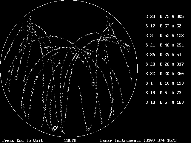
Yes! Here it is. A gif of the output of the program
from a play back. This data is from Redondo Beach
I think.

The sats leave little trails as they come up and set.
Paul,
I'm still trying to find that reference which caused me to claim that far
northern and southern lattitude have higher average EPE.  But notice that
in your trace, none of the satellites goes very far toward the north.
This is consistent with the satellites being in non-polar orbits.

The problem (IIRC) with far lattitudes, is the average satellite
elevations start getting compressed towards the horizon.  So your lat/lon
EPE is still ok, but your altitude EPE goes to pot.  At least, I think
that was the theory.  Another part of my brain is screaming "WAIT WAIT";
the satellites are ~16K miles up, so elevation compression shouldn't even
be an issue if you're standing on the pole.  *SIGH*   brain fade...

Still searching...
Russell Kent
I don't think the GPS sats are that high. 16K sounds like a sync orbit.
If that were the case the GPS sat's would be stationary over a point
on the earth's surface. There are at least 24 GPS sat's with up to a
dozen in view at any moment in time and they rise and set like
you would expect for a non-sync orbit.

I think a smart receiver can derive additional position information
by knowing the angle of the sat and the carrier RF phase difference
between widely spaced antennas on the airframe.

BTW a little bit more info about that display. The receiver is in the
center of the circle so a sat in the center would be directly overhead.

Paul Lamar

The Aircraft Rotary Engine Newsletter.              Powered by Linux.

http://home.earthlink.net/~rotaryeng/            http://www.linux.org