Bob Moore wrote:
Plug a GPS into the serial port and turn our PIC project into a USB AtoD
device and we have could have one heck of a system.  For a look at one
moving map program for this hardware go to
http://www.controlvision.com/map.htm
I'm using the Controlvision Moving Map, but on a Casio.
The software is great, but the Casio is difficult to read
in direct sunlight.  As soon as I get another spare $500,
I'm going to get one of the IPacs for better readability.
The Casio does have a great picture when out of the sun,
and I picked it up for only $179 on close-out from Office
Depot.  Driving it with a Lowrance GM-100, so I have roads
and cities on it's screen, and navaids, airports, and
obstructions on the Casio.  And as one who has driven
B-707s around Central and South America many times with
nothing more than an ADF, I've died and gone to navigation
heaven.

Bob Moore
BTW guys I think you can make your own high brightness LCD using
an ordinary notebook reflective LCD by peeling off the back reflective
layer and using a matrix of the new high brightness low current
white LEDs. One of my projects I will do anyday now :-)
Check Digi Key for the LED's.

High brightness back lit LCD's are going for 2 to 3 thousand bucks.

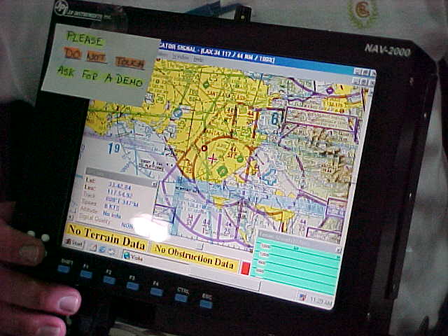
Here is an example from JPI.

Paul Lamar

The Aircraft Rotary Engine Newsletter.              Powered by Linux.

http://home.earthlink.net/~rotaryeng/            http://www.linux.org