DENIS SMITH wrote:
Having done quite a bit of IR during my stint with
Uncle S I can tell you that given the verticality of
much of the terrain (with many caves) there wouldn't
be much to see.  Any cloud cover would render IR
somewhat useless, and the lack of targets (vehicles
etc) makes it tough.  The only way to nail these guys
is with humint.
Too bad. BTW did they ever perfect that GPS controlled
para glider?

Paul Lamar
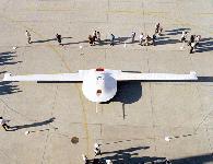
Run a bunch of Boeing Darkstars....SAR snap shots real time uploaded...you
can count the humps on a camels back in any light/weather...

http://www.abs.net/~maddock/LO/UAVs/TierIII-Darkstar.htm

http://www.spacedaily.com/news/darkstar-99a.html

http://www.af.mil/lib/afissues/1997/app_b_16.html

The best stealth in UAVs.....To bad I think they didn't order them instead
going for the longer range but much less stealth Global Hawk.

Cheers!
The AirCraft Rotary Engine NewsLetter.              Powered by Linux.
ACRE NL web site.
http://home.earthlink.net/~rotaryeng/            http://www.linux.org