Hi folks,
I see you have a lot of heat in parts of US. I would be glad if
I could to send rain. We had another 6mm at supper time last
night and another 1 over night. The rivers are going down but not
before taking roads out. Water running down ditches eroded the
roads in places. Other places it ran over the road and cut a new channel.
One place it does not go under the bridge anymore and a new bridge
needs to be built. Can not get to well sites and the new leases
are too soft to work at. When the level drops some more, I will
have to get out the gold pans as the high flow will have
deposited gold dust where it slowed.
Cheers and have a good day.
Dale Davies
Dale
Are you in Australia? I googled 'Rain in Australia " after your
comment and it seems to be confined to the bottom part of the
continent. Paul's favorite places seemed to be dry. I was there
last in '91 and it was dry. Peter
All of Oz is just great. I highly recommend it.
Paul Lamar
Hi Peter,
No. I am in west central Alberta, Canada. Whitecourt. 54.10960N and
115.81553W. Local airport is CYZU. Lots of flooding in west
central Alberta and southern Saskatchewan. Lot of other places
like Pakistan also flooded. Chile is buried under 7 - 9 ft of
snow. Other places in drought and fires.
Dale Davies
--
Hi Dale
I am west of Chicago and we have had heat and rain. A record 7"
in 2 hours last weekend and 2 more big storms since then. Hope you
keep pumping oil up there because our current leadership wants to
use your oil first.
Peter Duffecy
The waste product of Alberta oil sands is nice white clean beach
sand :) They ought to start selling that too.
Paul Lamar
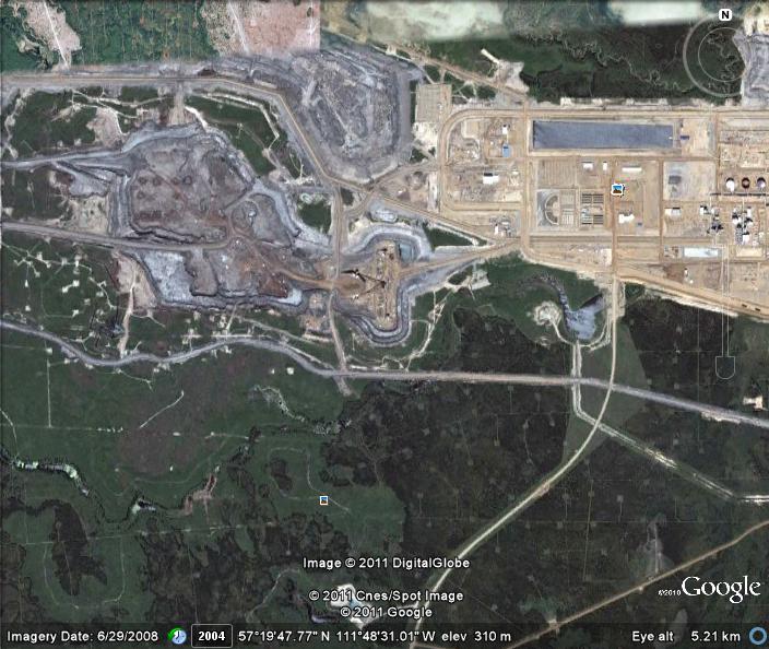
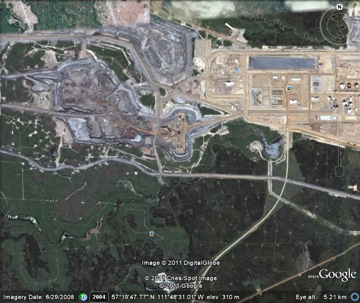
In the area shown in the satellite photo, there is the CNRL mine
and upgrader plant. That facility was evacuated for almost a month
earlier due to a forest fire that went through. There was another
large fire farther north on the edge of the Wood Buffalo National
Park. It was 300,000 hectares in size. Fires started before the sap
started running up the trees and the dead grass from last year
coupled with two weeks of strong east winds. The Wood Buffalo fire
was about 100 miles north to south. Winds of up to 60MPH took fire
through the town of Slave Lake and burned out 1/3 of the
buildings. Then after the residents were allowed back into town the
rain started and flooded basements. People were living in other
peoples basements while they try to get their lives back together.
We are supposed to start to get heat which will be almost
unbearable as we will not be used to it and it is forecast to be above
normal.
What a year!
Dale Davies
At 4.6 meg the ppt is too big to publish Dale. Try getting some
jpgs out of it and send those.
I have a question. Is there a Slave Lake AND a Great Slave Lake?
I flew the C182 up to Yellowknife over the Great Slave Lake.
Paul Lamar
Hi Dale,
What is the rectangular patches shown in the sat
pictures? are the patches farming paddocks or where the mining companys
have been clearing strips? There seems to be a big patch of oil
sands=-O , is this the oil sands that they have to use steam to boil
the oil out of the sand? I am in OZ., we had some
flooding here this year and last year, supposed to be "climate
change", not "global warming" anymore, funny that when one looks at
the weather records about 50-60 years, and 100-120 years ago the
same thing happened, but now people live in the rivers and creeks
and think they can control nature. Our smart government has
announced that they are going to have "Carbon Cops", with $1,000,000
fines and 10 years in prison if you burn carbon:'( , or somesuch
thing, nobody has told them that every living thing is made up of
carbon:-D . Sorry for the rant. John Burey.
Hi John,
I believe the strips are areas that have been clear cut logged.
The first photo (maps.html) is a SAGD site. Steam Assisted Gravity Drainage
facility. They usually have two sections and pump steam down directional wells
to heat the bitumen. Then they switch and recover the bitumen and water and
pump steam down the other side. Usually have pads with 10 to 12 pump jacks in
one place with a plant to separate the water out and reboil it.
The second photo is of the CNRL; Canadian Natural Resources Limited; Horizon
site. There is a road going horizontally across. Just above and in the center
is a V rotated 90 degrees counter clockwise. The tops are the dumps from the
strip mine. The bottom is the primary crusher, and the ore is sent up and down
to the slurry prep. Steam and caustic soda are added and then it can be sent
to the plants. The mine pit is to the left of the crusher and the camp and ore
prep and upgrader plants are to the right. The settling ponds are farther to
the left and up.
Dale Davies
Dale, that htm file comes across badly in text only.
One the other hand links to web sites are OK.
Use XP screen capture to capture the graphics and send them
as png or jpg. There is a key on most keyboards that captures
the screen. Then you must paste it into paint and save it as
a jpg. If you are using a Mac or Linux there is a free utility program
that captures the screen and automatically saves it.
Another crude way of doing is take a picture of the screen with a
digital camera :) That puts it in a jpg file.
Also check the size of the picture file. There are lots of jpg editors that
can change the size of a picture. You want to keep them down below
one meg if possible for email purposes. I understand that can be a bit
of trouble with recent high rez cameras so I can do that on this end.
Paul Lamar
--
The Rotary Engine NewsLetter. Powered by Linux.
ACRE NL web site.
http://www.rotaryeng.net
Youtube key word PaulLamar2
Copyright 1998-2011 All world wide rights reserved.